MARCH 24, 2021
 
  NEWS
 
Image: EuroGeographics  
New gateway connects users to Open Maps for Europe
 
Open Maps for Europe will signpost and provide easy access to pan-European open data created using official map, geospatial and land information.
 
Read More
 
View Here!
 
Photo: tuachanwatthana/iStock/Getty Images Plus/Getty Images

 
Info360.com provides digital twins for water industry
 
Water infrastructure software company Innovyze has released Info360.com, a cloud-based, artificial intelligence-powered platform for real-world water lifecycle management.
 
Read More
 
Screenshot: Hexagon Geospatial
 
Hexagon releases machine-learning GIS tool for smart cities
 
Hexagon’s Geospatial division has launched M.App Enterprise 2021, a significant update to its platform for creating geospatial and location intelligence applications.
 
Read More
 
Cover: Esri  
Esri releases latest edition of ArcGIS Desktop handbook
 
In the latest edition of this classroom textbook, Getting to Know ArcGIS Desktop 10.8 guides students and professionals through the fundamentals of making maps and analyzing data using the latest Esri ArcGIS Desktop software.
 
Read More
 
Photo: UgCS
 
Frontier Precision launches virtual user conference for 2021
 
The Frontier Precision 2021 TechXpo User Conference takes virtual its popular and informative in-person user conferences, sponsored by Frontier Precision for the past two decades.
 
Read More
 
Photo: Phase One 
 

Phase One announces P3 drone payload for asset inspection
 
Phase One, a developer of digital imaging technologies, has announced the P3 Payload, a versatile solution designed for fast, efficient and safe inspection of critical infrastructure with an unmanned aerial vehicle (UAV).
 
Read More
 
Photo: CyArk
 
Topcon partnership with CyArk aids cultural site archiving efforts
 
Topcon Positioning Group is partnering with CyArk, a non-profit organization committed to the conservation of cultural heritage sites around the globe.
 
Read More
 
  FROM THE PRO OEM + UAV NEWSLETTER
 
Photo: NEC Labs/Antonio Albany
 
 
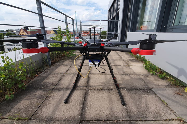
Search-and-rescue drone debuts, FAA issues remote ID rule
 
By Tony Murfin
GPS World columnist Tony Murfin looks at developments regarding a potential drone solution for finding disaster victims, the Federal Aviation Administration (FAA) issuing its remote ID rule and the Boeing Loyal Wingman's maiden flight in Australia.

 
Read More
 
  UPCOMING WEBINAR
 
Collecting Remote Asset Locations Using GNSS, GIS Apps and Laser Offset Mapping
 
Date: March 25
Sponsored Content by: Laser Technology Inc.
 
Summary: Map more, move less. By combining laser rangefinders with your GNSS receiver, smart device and preferred GIS mapping app, you can collect remote assets safely and efficiently. Learn about the different mapping workflows and the offset position accuracies you can achieve with equipment you already own.  

Speakers:
Derrick Reish, Senior Product Manager, Laser Technology Inc.
Mike George, GISP, sUAS, GIS Director, Project Manager, DDSI Global

 
Register Here
 
View Here!
 
Photo: GSS Logo Logo: Twitter  Logo: Facebook  Logo: LinkedIn

You are subscribed to Geospatial Solutions Monthly as [email protected].

Forward to a friend | Change your subscription preferences | New subscriber sign-up

If you wish to leave this mailing list, simply unsubscribe. | Refer to our Privacy Policy.

GPS World is a property of North Coast Media, LLC.
1360 E. Ninth St., 10th Floor, Cleveland, OH 44114
© 2021 North Coast Media. All Rights Reserved.
Reproduction in whole or in part is prohibited without written permission.