THURSDAY, MAY 8, 2025 TODAY:
STORM ALERT
Partly Sunny
PM Rain, Storms
Highs: 75-80
Winds: South 5-10 mph
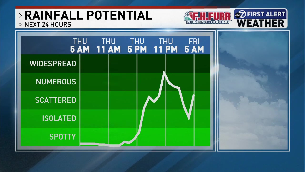
The day will start off dry and comfortable, but our next weather maker will bring the return of rain and storm chances late day. A highly isolated shower is possible during the afternoon with more widespread areas of rain and storms developing after 6 p.m. The Storm Prediction Center has the DMV in the Level 1 out of 5 risk category for storms that could contain damaging winds. Heavy rain could also lead to isolated flooding. TONIGHT:
Storms Ending, Areas of Rain
Lows: 56-62
Winds: Light
Wet weather is likely overnight with areas of rain continuing. Pockets of moderate to heavy rain are possible.
FRIDAY:
Areas of Rain
Highs: 60-65
Winds: North 5-10 mph
Cloudy, cool, and wet weather rounds out the week with high temperatures 10+ degrees below average. Rain is likely during the morning and afternoon hours with the wet weather ending by 6 p.m., so your Friday night plans may be looking better for outdoor plans. Rainfall totals will range from .50 - 1.00".
SATURDAY:
Partly to Mostly Sunny
Highs: around 75
Winds: Northwest 5-10
After a chilly morning with wake-up temperatures in the 40s lower 50s, it will be a gorgeous spring day with a mix of sun and clouds. SUNDAY:
Partly Cloudy
Highs: Low 80s
Winds: North 5-10 mph
Beautiful weather is on the way for Mother's Day! It will be another cool start with early morning temperatures in the upper 40s to mid 50s, but temperatures will warm into the low 80s by the afternoon with sunshine, light winds, and low humidity. Download the First Alert Weather app to stay up to date with the latest forecast. |